Google Maps has launches street view in 10 Indian cities, including Hyderabad
Wed 27 Jul 2022, 20:56:52
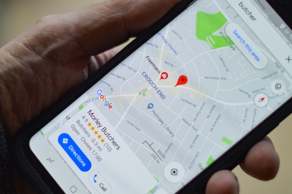
New Delhi: Google Maps has launched its street view service across 10 cities in India in partnership with two local companies, the firm said on Wednesday.
The government had previously not allowed showing of panoramic images of roads and other sites for security reasons.
In a statement, Google said Street View is being launched in partnership with Genesys International and Tech Mahindra.
“Starting today, Street View will be available on Google Maps with fresh imagery licensed from local partners covering over 1,50,000 km across ten cities in India, including Bengaluru, Chennai, Delhi, Mumbai, Hyderabad, Pune, Nashik, Vadodara, Ahmednagar, and Amritsar,” it said.
Google, Genesys International, and Tech Mahindra plan to expand this to more than 50 cities by the end of 2022.
This India launch marks the first time in the world that Street View is being brought to life completely by local partners.
Also, Google Maps will now show speed limits data shared by the traffic authorities, starting with Bengaluru.
Google also announced its partnership with Bengaluru traffic police as part of its efforts towards delivering models that better optimise traffic light timings.
“This is helping the
local traffic authority manage road congestion at key intersections, and will eventually scale across the city,” the statement said, adding, “Google will further expand this to Kolkata and Hyderabad in partnership with local traffic authorities.” Speaking of the announcements, Miriam Karthika Daniel, VP – Google Maps Experiences, said the launch of Street View in India will be instrumental in delivering a more helpful user experience, from virtually visiting locations to getting a better sense of local businesses and establishments.
local traffic authority manage road congestion at key intersections, and will eventually scale across the city,” the statement said, adding, “Google will further expand this to Kolkata and Hyderabad in partnership with local traffic authorities.” Speaking of the announcements, Miriam Karthika Daniel, VP – Google Maps Experiences, said the launch of Street View in India will be instrumental in delivering a more helpful user experience, from virtually visiting locations to getting a better sense of local businesses and establishments.
Sajid Malik, Managing Director of Genesys International Corporation Ltd, said, “We were the first Indian firm to perform street imaging of all major cities in India. Our fleet is still swiftly photographing Indian cities, bringing to life our city’s amazing tapestry of streets and landmarks and allowing us to comfortably visit our old neighbourhoods or plan our trips.” Street View APIs will also be available to local developers enabling them to deliver richer mapping experiences in their services.
Additionally, Google announced its collaboration with the Central Pollution Control Board (CPCB) to provide air quality information.
This information can be accessed by tapping the ‘Layers’ button at the top right in their Maps app and selecting the ‘Air Quality’ option.
No Comments For This Post, Be first to write a Comment.
Most viewed from General
Most viewed from World
AIMIM News
Latest Urdu News
Most Viewed
May 26, 2020
Do you think Canada-India relations will improve under New PM Mark Carney?
Latest Videos View All
Like Us
Home
About Us
Advertise With Us
All Polls
Epaper Archives
Privacy Policy
Contact Us
Download Etemaad App
© 2025 Etemaad Daily News, All Rights Reserved.





.jpg)
.jpg)
.jpg)
.jpg)
.jpg)
.jpg)
.jpg)
.jpg)
.jpg)
.jpg)
.jpg)
.jpg)


