17 days of continues rain can submerge half of Hyderabad: BITS-Pilani study
Sat 16 Oct 2021, 19:30:11
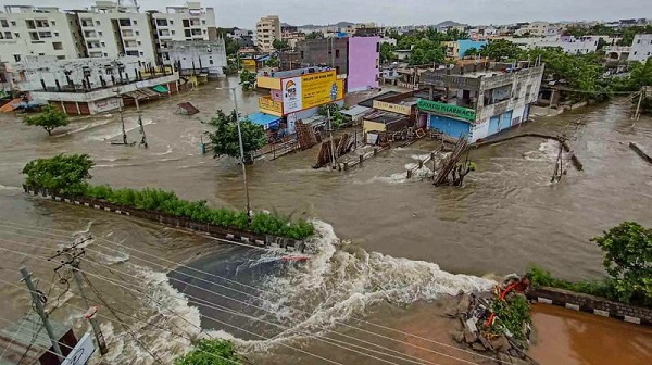
In the event of an extreme weather change, where up to 440.35 mm of rain occurs for over 17 days, nearly 334 sq km of area in the GHMC limits will be submerged in water, according to a new study by civil engineers from BITS-Pilani, Hyderabad. The total limit of GHMC is roughly 625 sq km, which implies that about half the city could be under water in such a scenario.
The said prediction was made in the study titled “Urban flood risk analysis of buildings using HEC-RAS 2D in climate change framework”, which used a Hydrologic Engineering Centre’s River Analysis System 2D model. It study was published in the H2Open Journal.
Speaking to media about the model, R Madhuri, Research Scholar at Department of Civil Engineering, who is also the lead author of the paper, explains that she predicted the impact of urban flood risk in the GHMC limits in two scenarios or RCP’s (Representative Concentration pathways) - 6.0 and 8.5, wherein the rains which are predicted to occur are 440.35mm in 17 days and 624.2 mm in 19 days.
It may be noted that the last of such extreme weather events seen in the GHMC limits, which was used as a control number for the model, was across nine days with 215.9mm rains. In 2021, weather experts noted that extremely heavy rainfall events occurred from August 24 to September
5, with three individual days having up to 90mm-100mm of heavy rainfalls.
5, with three individual days having up to 90mm-100mm of heavy rainfalls.
Charminar, LB Nagar most prone to floods
Across the city’s various flood points, some storm water zones were more vulnerable than others. Most predominantly, areas vulnerable to flooding were seen in zones 1, 2 and 4 ( parts of current day LB Nagar and Charminar zone) and sections of zones 12 (parts of current day Kukatpally and Alwal zone), finds the study. In fact, Zones 1, 2, and 4 were found to have terrains that aid the flooding process. This has been visible during the 2020 and 2021 rains as well.
The report also says that these areas are specifically more flood prone because of the terrain and also due to the high level of concretisation of the area leading to less percolation of water. In the entire GHMC limits, the “impervious land” of areas with water-resistant structures have gone from 55% in 1995 to 73% in 2016 and it would eventually rise to 85% by 2050.
“This is a climate modelling system where the variables like rainfall, elevation of the topography, distance from stream, areas for absorption all come into play. With this system, we can also predict the flooding caused by rains of much lesser capacities, if the data is more and more refined,” added Professor K Srinivas Raju.
No Comments For This Post, Be first to write a Comment.
Most viewed from Hyderabad
Most viewed from World
AIMIM News
Latest Urdu News
Most Viewed
May 26, 2020
Do you think Canada-India relations will improve under New PM Mark Carney?
Latest Videos View All
Like Us
Home
About Us
Advertise With Us
All Polls
Epaper Archives
Privacy Policy
Contact Us
Download Etemaad App
© 2025 Etemaad Daily News, All Rights Reserved.

.jpg)
.jpg)
.jpg)
.jpg)
.jpg)
.jpg)
.jpg)





.jpg)
.jpg)
.jpg)
.jpg)
.jpg)
.jpg)
.jpg)
.jpg)
.jpg)
.jpg)
