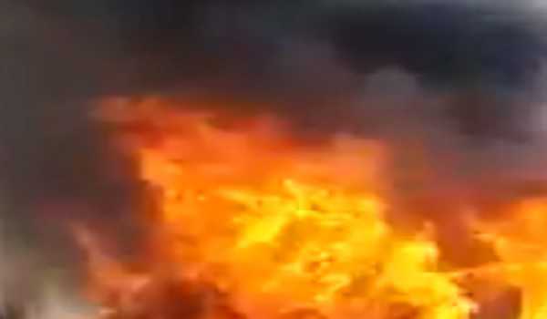
Evacuations ordered as Florida braces for Hurricane Michael
Tue 09 Oct 2018, 13:40:31
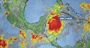
Miami: Residents of northwest Florida had until early Tuesday to leave their homes ahead of Hurricane Michael, forecast to crash ashore midweek as a major Category 3 storm with “life-threatening” flash flooding possible.
Governor Rick Scott’s office said mandatory evacuation orders were in place for parts of Bay County, which includes the popular Panama City beach resort, and areas in nearby Gulf and Franklin counties.
“EVERY FAMILY must be prepared. We can rebuild your home, but we cannot rebuild your life,” Scott said.
The alert came after the tropical storm system strengthened to a Category 1 hurricane, packing maximum sustained winds late Monday of 85 miles (140 kilometers) per hour, the Miami-based National Hurricane Center (NHC) said.
By 0001 GMT (Tuesday), Michael was off the western tip of Cuba’s Pinar del Rio province, churning to the north at 12 miles per hour (19 kilometers per hour), across from Mexico’s Yucatan peninsula. Michael was forecast to push through warm, relatively shallow Gulf of Mexico waters before moving inland over the northern Gulf coast of Florida.
Michael was forecast to have the power to uproot trees, block roads and knock out power for days by the time it hits Florida on Wednesday. Then it is forecast to lash the southeastern United States through Thursday.
“Steady to rapid strengthening is forecast during the next day or so, and Michael is forecast to become a major hurricane by Tuesday night,” the NHC said.
Earlier it said Michael could produce three life-threatening hazards along portions of the northeastern Gulf Coast: storm surge, heavy rainfall, and hurricane-force winds, with storm surge and hurricane watches in effect.
The first rains from Michael already started to soak the Florida Keys on Monday. Up to four inches (10 centimeters) were expected to fall through Tuesday.
Late Monday, residents of far western Cuba were forecast to get up to eight inches of rain.
“This rainfall
could lead to life-threatening flash floods and mudslides,” the NHC warned.
could lead to life-threatening flash floods and mudslides,” the NHC warned.
President Donald Trump, who was in Orlando delivering an address to a global association of police chiefs, said the federal government was ready and urged residents to be prepared for the worst.
“Can you believe it? It looks like another big one,” he said.
Scott declared a state of emergency for 35 counties, activating 1,250 National Guard troops in preparation for the storm.
“We are running out of time,” the Republican governor said on Twitter. “TODAY is the day to get a plan, because tomorrow could be too late.” “This storm will bring torrential rain, heavy winds and dangerous storm surges to many areas of our state,” he tweeted.
Florida State University announced it was closing for the week on Tuesday, along with schools in Leon County, home to the state capital Tallahassee.
Tallahassee’s Democratic Mayor Andrew Gillum, who is campaigning to succeed Scott as governor in next month’s elections, suspended his campaign and returned to the state capital to oversee storm preparations.
The Carolinas are still recovering from Hurricane Florence, which left dozens dead and is estimated to have caused billions of dollars in damage last month.
It made landfall on the coast as a Category 1 hurricane on September 14 and drenched some parts of the state with 40 inches of rain.
Last year saw a string of catastrophic storms batter the western Atlantic — including Irma, Maria and Hurricane Harvey — causing a record-equaling $125 billion in damage when it flooded the Houston metropolitan area.
Scientists have long warned that global warming will make cyclones more destructive, and some say the evidence for this may already be visible.
At their most fearsome, these low-pressure weather fronts pack more power than the energy released by the atomic bomb that levelled Hiroshima.
No Comments For This Post, Be first to write a Comment.
Most viewed from International
Most viewed from World
AIMIM News
Latest Urdu News
Most Viewed
May 26, 2020
Do you think Canada-India relations will improve under New PM Mark Carney?
Latest Videos View All
Like Us
Home
About Us
Advertise With Us
All Polls
Epaper Archives
Privacy Policy
Contact Us
Download Etemaad App
© 2025 Etemaad Daily News, All Rights Reserved.







.jpg)
.jpg)
.jpg)
