India calls Pak move to include J&K in new map as politically absurd
Wed 05 Aug 2020, 16:34:45
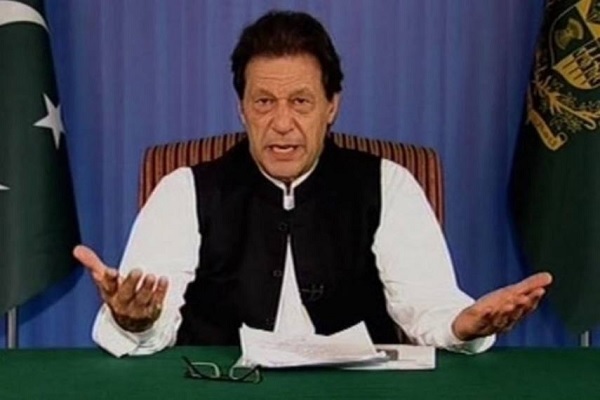
NEW DELHI: First it was Nepal. Now it seems Pakistan has followed in Kathmandu’s footsteps and committed cartographic aggression by showing sections of India as within its boundaries in a new map that was made public on Tuesday, according to news reports.
India slammed it as an “exercise in political absurdity" without “legal validity nor international credibility."
The new “political" map of Pakistan, unveiled by Prime Minister Imran Khan, shows all of India’s Union territory of Jammu and Kashmir—besides the Junagadh region of Gujarat —as falling within its borders.
Traditionally Pakistani maps have included parts of Jammu and Kashmir like Gilgit and Baltistan as lying within Pakistani borders.
“This is the most historic day in Pakistan’s history," Khan was quoted as saying at a press conference where the made the map public. The map, backed by all political parties, aims to oppose “the Indian government’s illegal act of 5 August last year," Khan said in reference to India’s Parliament revoking Article 370 of its Constitution that bestowed special status on Kashmir.
Pakistan, caught off guard, was incensed by the move as it integrated the region more closely with India and took it off the dialogue table with Islamabad.
New Delhi said the administrative change was aimed at ensuring development reached the people of the region who had suffered from decades of terrorism perpetrated by Pakistan.
On Tuesday, India’s response was sharp.
“This is an exercise in political absurdity,
laying untenable claims to territories in the Indian State of Gujarat and our Union Territories of Jammu and Kashmir and of Ladakh," the foreign ministry said.
laying untenable claims to territories in the Indian State of Gujarat and our Union Territories of Jammu and Kashmir and of Ladakh," the foreign ministry said.
“These ridiculous assertions have neither legal validity nor international credibility. In fact, this new effort only confirms reality of Pakistan’s obsession with territorial aggrandisement supported by cross-border terrorism."
In its actions, Islamabad seemed to be taking a leaf out of Nepal’s book.
In May, Nepal unveiled a new map which included the areas of Limpiyadhura, Lipulekh and Kalapani as lying within its borders. While India and Nepal had been showing the areas of Lipulekh and Kalapani as parts of their respective territories, Kathmandu in May added a third area—Limpiyadhura—to its territory.
India criticized the moved as “unilateral" and as “not based on historical facts and evidence."
Obviously expressing that "such fake broadening of regional cases won't be acknowledged by India," the unfamiliar service asked Nepal to "abstain from such outlandish cartographic attestation and regard India's sway and regional trustworthiness." Undeterred, Nepal felt free to get the guide passed by its parliament in June.
Pakistan's move likewise comes against the setting of a fringe stalemate among India and China,with pressures running intense since May when New Delhi distinguished numerous interruptions into Indian domain by the Chinese armed force.
Talks at the level of diplomats and senior military commanders have not been able to break the impasse so far.
No Comments For This Post, Be first to write a Comment.
Most viewed from International
Most viewed from World
AIMIM News
Delhi Assembly polls: Owaisi leads Padyatra in Okhla
Feb 01, 2025
We reject this Waqf Amendment Bill: Asaduddin Owaisi
Jan 30, 2025
Latest Urdu News
Most Viewed
May 26, 2020
Which team will win the ICC Men's Champions Trophy 2025 held in Pakistan/Dubai?
Latest Videos View All
Like Us
Home
About Us
Advertise With Us
All Polls
Epaper Archives
Privacy Policy
Contact Us
Download Etemaad App
© 2025 Etemaad Daily News, All Rights Reserved.

.jpg)
.jpg)
.jpg)


.jpg)


