


IMD predcits possible cyclone likely to reach West Bengal-Bangladesh coast by Oct 25
Thu 20 Oct 2022, 23:00:30
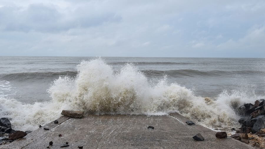
A possible cyclonic formation in the Bay of Bengal is likely to reach West Bengal-Bangladesh coasts by October 25, skirting Odisha, the India Meteorological Department (IMD) said on Thursday.
A low-pressure area has been formed in the Bay of Bengal on Thursday and it is likely to intensify into a cyclonic storm over the next four days, it said in a statement.
The low-pressure area is very likely to move west-northwestwards and develop into a depression over the east-central and adjoining southeast Bay of Bengal around October 22.
It is likely to intensify into a deep depression by October 23.
"Subsequently, it is likely to re-curve northwards and intensify into a cyclonic storm over the west-central and adjoining
east-central Bay of Bengal by October 24. Thereafter, it is likely to gradually move north-northeastwards and reach near the West Bengal-Bangladesh coasts by October 25, skirting Odisha," IMD Director General Mrutunjay Mohapatra said.
east-central Bay of Bengal by October 24. Thereafter, it is likely to gradually move north-northeastwards and reach near the West Bengal-Bangladesh coasts by October 25, skirting Odisha," IMD Director General Mrutunjay Mohapatra said.
He, however, said the IMD is yet to make a forecast on the intensity and wind speed of the cyclone.
Mohapatra said coastal Odisha will experience heavy to very heavy rainfall in isolated places from October 23.
Puri, Kendrapada, and Jagatsinghpur districts are likely to witness intense spells of rain on October 23, the Regional Meteorological Centre in Bhubaneswar said.
Earlier in the morning, the IMD said the low-pressure area is likely to deepen into a depression by October 22 and into a cyclonic storm by October 24.
No Comments For This Post, Be first to write a Comment.
Most viewed from National


.jpg)
.jpg)


Most viewed from World


.jpg)
.jpg)
.jpg)
.jpg)
.jpg)

.jpg)
.jpg)

Todays Epaper

English Weekly


AIMIM News


Delhi Assembly polls: Owaisi leads Padyatra in Okhla
Feb 01, 2025

We reject this Waqf Amendment Bill: Asaduddin Owaisi
Jan 30, 2025


Latest Urdu News
Most Viewed
May 26, 2020
Which team will win the ICC Men's Champions Trophy 2025 held in Pakistan/Dubai?
Latest Videos View All


Like Us
Home
About Us
Advertise With Us
All Polls
Epaper Archives
Privacy Policy
Contact Us
Download Etemaad App
© 2025 Etemaad Daily News, All Rights Reserved.